Prague Plans Extensive Redesign of the Magistrale
The aim of the project is to create a modern, welcoming, and safe environment for all road users
Prague is planning a comprehensive redesign of the Magistrale to make it safer and more attractive for all road users. The goal is to create modern, green infrastructure that meets both the demands of traffic and the needs of residents and visitors.
Prague is planning a major redesign of the streets Legerova, Sokolská, and Mezibranská, which will fundamentally alter these key transport routes. The project aims to create a welcoming and safe environment for all road users – pedestrians, drivers, and cyclists – as well as for residents and visitors. The redesign will cover the section from the area around the Nuselský Bridge to the Museum Oasis. A feasibility study is currently being prepared.
The entire block between Mezibranská, Sokolská, and Legerova was developed in the second half of the 19th century in the area of the former medieval and baroque city walls of Prague. The goal was to connect the New Town with the growing Vinohrady district.
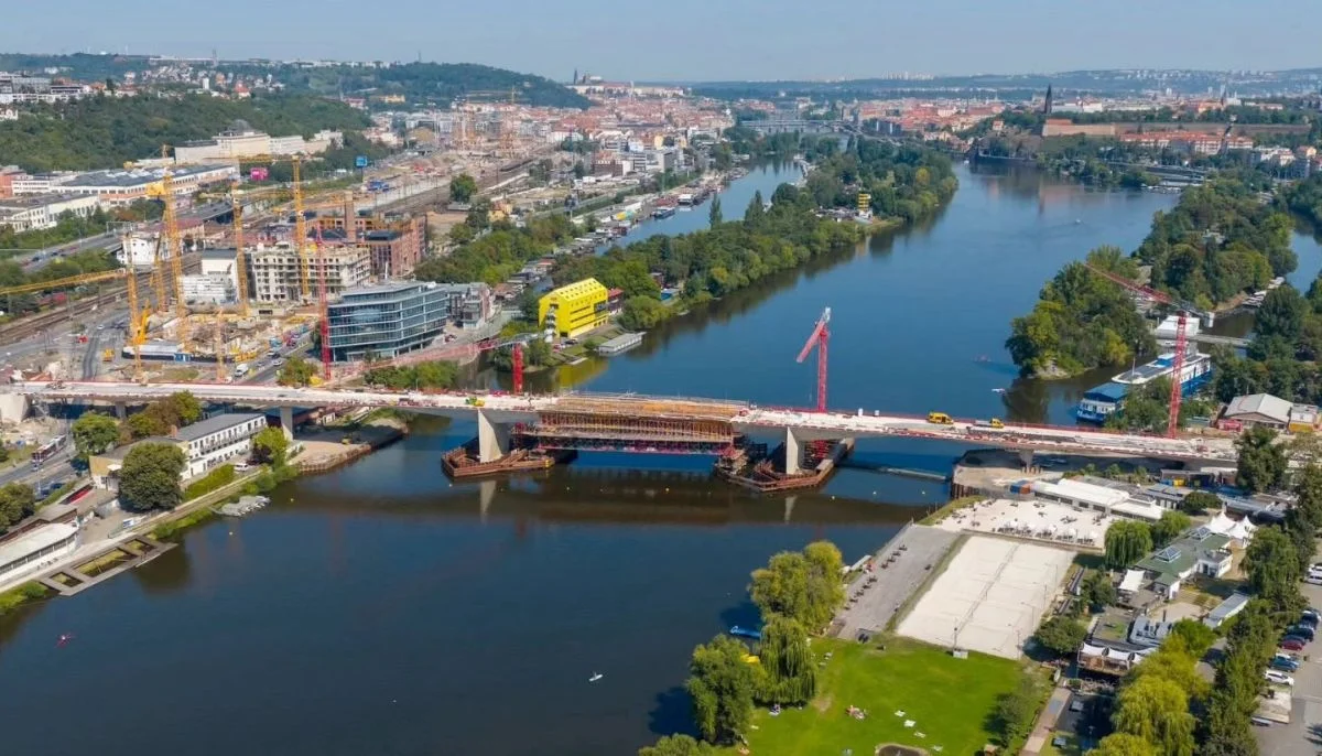
For decades, both streets were dead ends at their southern ends, as continuation through the Nuselské Valley was blocked. As a result, they were quiet streets with rows of trees on both sides. However, with the development of the city, the need to connect the newly developing Pankrác plateau with the city centre grew. During the First Republic, plans were made to build a bridge over the Nuselské Valley at the southern extension of these streets. The bridge’s construction began in 1967, and it was opened in 1973 as part of the transport axis known as the North-South Magistrale.
Since then, some smaller interventions have been made, such as new crossings in Wenzigova Street and the revitalisation of the southern part of I. P. Pavlova. However, the overall appearance of the streets remains in an unsatisfactory state, reminiscent of the late 1970s.
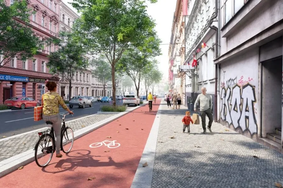
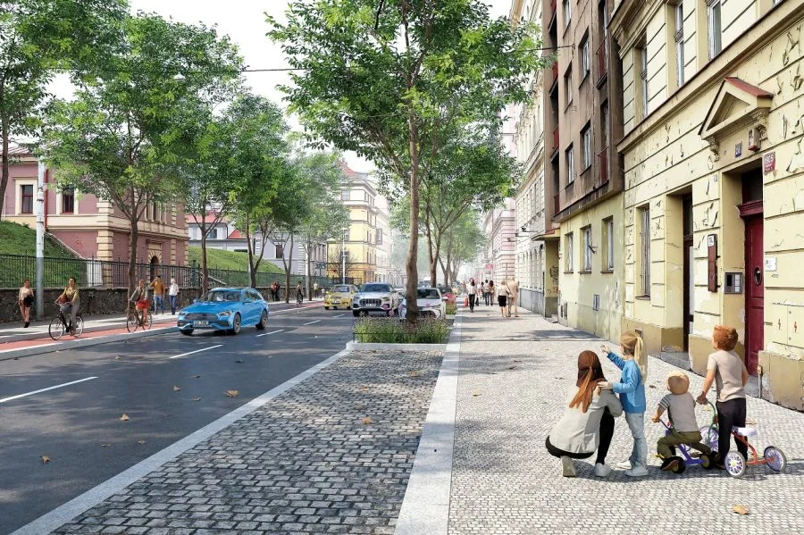
A complete redesign of the streets Sokolská, Mezibranská, and Legerova, from façade to façade, is planned. The road surfaces, pavements, street furniture, and other public space elements will be renovated. New rows of trees will be planted along the streets, featuring large-growing species. Additionally, a blue-green infrastructure will be implemented. The project places special emphasis on managing rainwater through infiltration strips and the sloping of paved areas towards the trees, creating optimal conditions for their growth.
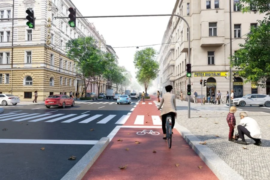
Some underpasses will be replaced by at-grade crossings, making it easier for pedestrians and people with limited mobility to navigate. New crossings will also be added. Cyclists will benefit from separate bike lanes, 2.5 metres wide in both directions, ensuring safe and smooth movement. Parking will be addressed with modern, elongated parking bays with cobblestone paving. The number and distribution of parking spaces will be determined based on local conditions and needs.
The entire project takes into account local conditions, the street width, the location of driveways, and the use of building ground floors. The unity of the streets will be preserved, while respecting their natural diversity. Finally, new street furniture will be added, enhancing the overall look and enriching the public space.
More from News